
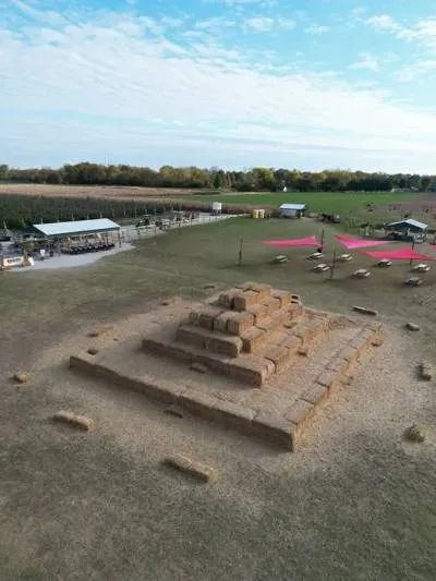
Aerial Photography & Commercial Imaging
Capture stunning aerial perspectives of your property, project, or event. Our high-resolution drone photography delivers professional imagery perfect for real estate listings, marketing materials, and project documentation.
- High-resolution 4K imagery
- Real estate marketing photos
- Commercial property showcases
- 48-72 hour delivery
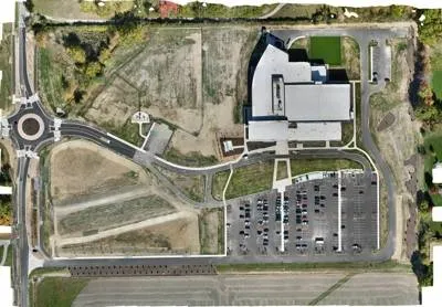
Construction Site Mapping & Visual Documentation
Comprehensive aerial mapping and documentation for construction sites. Create accurate orthomosaic maps, track project progress, and maintain detailed visual records throughout your build.
- 2D orthomosaic maps
- Site layout documentation
- Stockpile & inventory tracking
- Shareable project reports
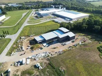
Construction Site Monitoring & Progress Tracking
Keep stakeholders informed with regular aerial updates of your construction project. Our progress monitoring service provides consistent, date-stamped imagery to track milestones, changes, and overall development.
- Scheduled recurring flights
- Date-stamped progress imagery
- Before & after comparisons
- Stakeholder-ready reports
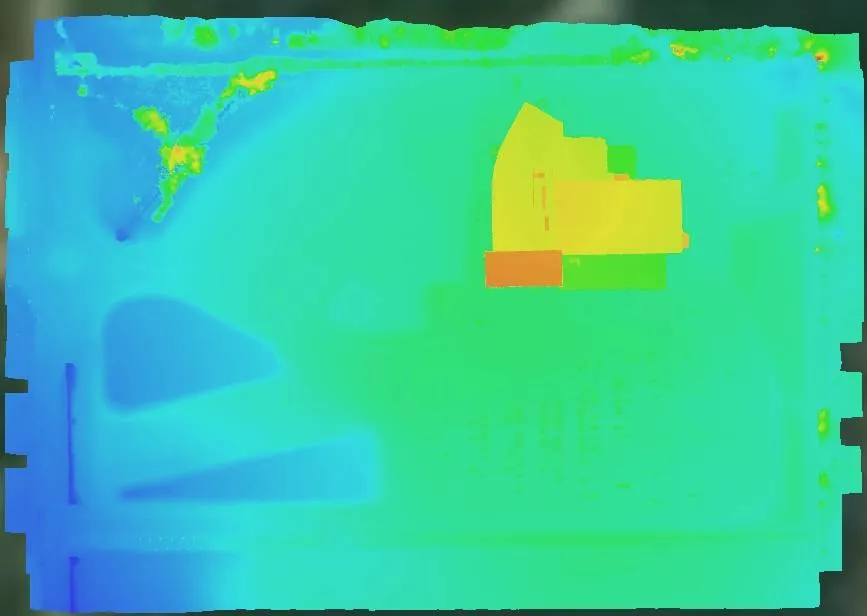
Advanced Mapping Deliverables
Beyond standard aerial photography, we provide specialized mapping outputs for planning, analysis, and documentation purposes.
 Visual Use Only
Digital Elevation Models (DEMs)
Visual representations of terrain elevation data. Useful for understanding topography, drainage patterns, and site characteristics for planning purposes.
 Visual Use Only
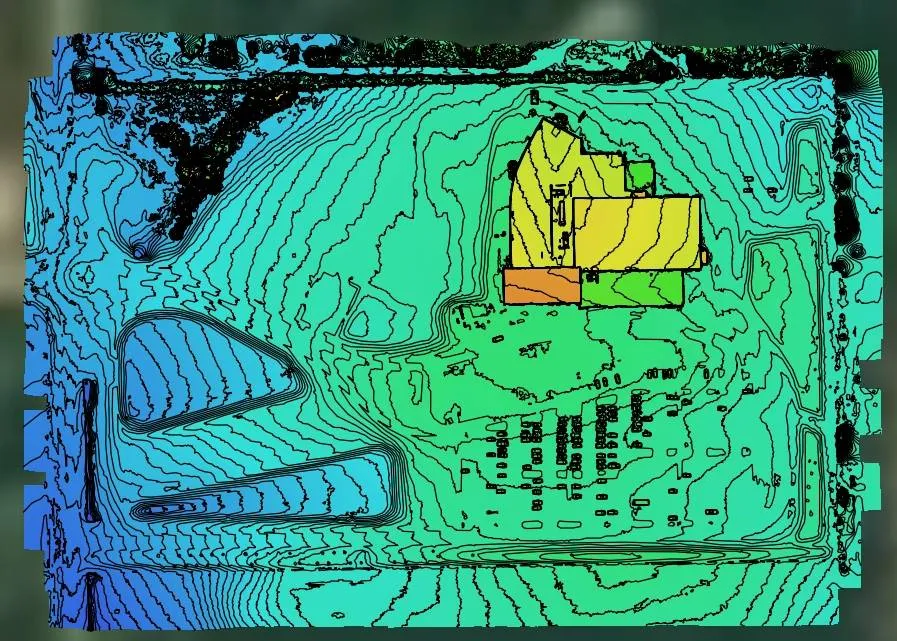
Contour Lines (1-5 ft Intervals)
Visual contour maps showing elevation changes across your site. Helpful for preliminary planning, grading visualization, and understanding land slope.